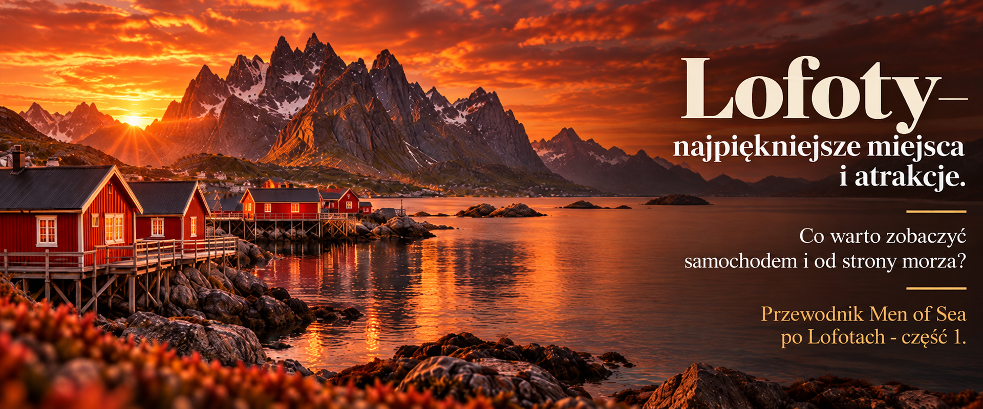
Things to Do in Lofoten – Best Places, Attractions, Hikes and What to See by Car and from the Sea
Things to Do in Lofoten – Best Places, Attractions, Hikes and What to See by Car and from the Sea
Men of Sea Guide to Lofoten – Part 1
For more than 10 years, we have been organising expeditions across the Arctic North. Drawing on that first-hand experience, we have created our Men of Sea Guide to Lofoten, starting with the places, attractions and landscapes that we believe are most worth seeing across the archipelago.
There are many things to do in Lofoten, and the islands can be explored in very different ways. You can drive from one iconic location to another along the E10. You can hike into the mountains or walk to beaches hidden between steep peaks. But you can also experience the archipelago the way fishermen and local communities have seen it for centuries – from the sea.
In our experience, combining these perspectives gives you the most complete understanding of Lofoten.
A car allows you to reach places such as Reine, Hamnøy, Haukland, Unstad and Å. A yacht allows you to sail into Trollfjorden, see mountains rising directly from Vestfjorden, approach traditional fishing villages from the water and reach places where no road exists.
In short – what should you see in Lofoten?
If you are visiting the Lofoten Islands for the first time, we would put Reine and Reinefjorden, Hamnøy, Å, Nusfjord, Henningsvær, Svolvær and Trollfjorden high on the list.
The beaches of Haukland, Uttakleiv, Skagsanden and Kvalvika are also among the places worth seeing, and we recommend adding at least one Lofoten hike such as Reinebringen, Ryten, Mannen or Festvågtinden. One of the biggest mistakes is to treat Lofoten purely as a road trip along the E10.
The archipelago has always been shaped by the sea, and many of its most spectacular landscapes are best understood from the water.
Lofoten road trip – 230 km through one of Europe’s most spectacular archipelagos
The Norwegian Scenic Route Lofoten runs from Å to Raftsundet and covers approximately 230 kilometres. Side roads lead to places including Nusfjord, Unstad, Uttakleiv, Henningsvær and Eggum. A road trip therefore gives you access to a large proportion of the main Lofoten attractions. But a road map can also create a slightly misleading picture of the islands.
Lofoten is not simply a strip of land crossed by the E10. It is an archipelago of islands, straits, fjords, bays and mountains that in many places rise almost vertically from the sea. And that is why Lofoten looks completely different from the water.
Reine – an icon of southern Lofoten
Reine lies between Vestfjorden and Reinefjorden and is one of the most recognisable places in the entire Lofoten archipelago. Only around 300 people live here, yet its red rorbuer, tiny islands linked by bridges and dramatic mountains rising directly above the water have made Reine one of the visual symbols of Norway.
If you are exploring Lofoten by car, it is worth stopping at Reinehalsen and spending some time walking around the village itself.
But Reine looks very different when approached from the water. As you sail into Reinefjorden, the houses and rorbuer stop dominating the landscape. Instead, the mountains take over – enormous, steep walls surrounding remarkably small settlements.
Reinefjorden – one of the most beautiful fjords in Lofoten
For us, Reinefjorden is one of the places that best demonstrates why travelling by car and travelling by yacht can reveal two different versions of Lofoten. From the road, you see fragments of the fjord. From the water, you are inside the landscape.
Local boats also run from Reine to Vindstad. From there, you can hike to Bunesstranda, a beach with no road access. The walk from Vindstad is approximately 2.8 km each way and generally takes around 2–4 hours for the return trip.
Hamnøy and Sakrisøy – classic Lofoten scenery
Hamnøy and Sakrisøy are among the most photogenic places in southern Lofoten. Bridges, small islands, yellow and red houses and enormous mountains in the background create the landscape most people imagine when they think of the Lofoten Islands. Both are very easy to reach by car and lie only a few minutes from Reine.
For photographers, they are particularly interesting in the morning, evening and during rapidly changing weather. A perfectly blue sky may look beautiful, but low clouds, snow showers, rain and sunlight breaking through gaps between the mountains often produce far more distinctive photographs.
Å – the end of the E10
Å lies at the southern end of Moskenesøya and is one of the best places in Lofoten to understand the culture of the traditional fishing communities. The Norwegian Fishing Village Museum includes rorbuer, a boathouse, forge, bakery and displays connected with historic cod-liver-oil production. The story presented here spans roughly 250 years of life shaped by fishing. We have visited many museums during our travels, and we consider this one particularly worthwhile.
Å also helps explain something fundamental about Lofoten: the islands were not created as a tourist attraction. For centuries, life here revolved around the sea and fish.
Nusfjord – the fishing history of Lofoten
Nusfjord lies on Flakstadøya and is one of the best-preserved historic fiskevær, or traditional fishing villages, in the archipelago. Its narrow bay, rorbuer, old harbour buildings and fish-drying racks create an atmosphere very different from larger Svolvær. By car, Nusfjord is reached along a side road from the E10.
But arriving by yacht creates a completely different first impression. At first, you see a tiny harbour surrounded by steep mountains. Only after stepping ashore does the full structure of the old settlement become visible. We still remember the first time we sailed into Nusfjord. As we passed the rocks and entered the small bay, another world suddenly appeared in front of us. Because we were sailing directly into its centre, for a moment it felt as though we had become part of that world ourselves.
That kind of arrival is difficult to reproduce from a car park.
Henningsvær – a fishing village built on islands
Henningsvær lies around 25 km from Svolvær and is built across several small islands linked by bridges. Just over 500 people live here. It is worth spending at least a few hours walking around the harbour, galleries, cafés and old streets.
From a sailor’s perspective, however, Henningsvær is even more interesting. You do not simply arrive in the village – you sail between its islands and channels.
We sometimes call it the Venice of Lofoten. From the water, it becomes much easier to understand why the settlement developed here. The harbour is naturally protected, while for generations the sea was the main transport route.
Svolvær – the main town and transport hub of Lofoten
Svolvær is the largest town in the archipelago, with a population of almost 5,000, and one of the main transport hubs in Lofoten. It can be reached by plane, bus, ferry, express boat and Hurtigruten. Svolvær is also a natural departure point for trips to Trollfjorden, with RIBs and other boats heading into Raftsundet and towards the fjord.
There are several attractive hikes around Svolvær. Options range from easier walks around scenic Lille Kongsvatnet and hikes to Linken or Tjeldbergtinden, to more demanding routes towards Fløya and Djevelporten.
Svolvær also has several car-rental companies, making it a convenient starting point for exploring the northern part of Lofoten.
Trollfjorden – a place you cannot reach by car
Trollfjorden is one of the strongest arguments for experiencing at least part of Lofoten from the sea.
There is no road into Trollfjorden.
The fjord lies off Raftsundet. Its entrance is only around 100 metres wide, while the surrounding mountains rise to approximately 1,100 metres. The sense of scale is what makes the approach so memorable. From a distance, the entrance looks almost like a narrow crack between the mountains.
Only once you sail inside do the rock walls begin to open and the fjord becomes wider. During our sailing trips, this is one of the places where the perspective of a yacht matters most. We do not look at Trollfjorden from a viewpoint.
We sail between its walls.
White-tailed eagles around Trollfjorden
Raftsundet and Trollfjorden are well known for white-tailed eagles, and dedicated sea-eagle safaris operate in the area. The birds can also be seen in many other parts of Lofoten.
A yacht often provides an excellent observation platform, particularly when white-tailed eagles are patrolling the coastline.
Best hikes in Lofoten
The mountains of Lofoten are not particularly high by Alpine standards, but they should not be underestimated.
Many Lofoten hiking trails are steep, wet and exposed, and their difficulty can change rapidly after rain, snow or freezing temperatures.
Hike – Elevation – Distance / time – Difficulty – Main highlight
Reinebringen – 484 m – approx. 2 km return / 1–2 h – moderate / demanding – Reinefjorden panorama
Ryten – 543 m – approx. 3.5 km to summit / 3–5 h depending on route – moderate – view over Kvalvika
Kvalvika — approx. 3 km each way – moderate – wild beach
Festvågtinden – 541 m – 1.3 km each way / 60–90 min ascent – demanding – Henningsvær from above
Mannen – 400 m – 1.75 km each way / 2–3 h return – moderate, exposed – Haukland and Uttakleiv
Tjeldbergtinden – 367 m – approx. 1 h ascent – moderate – Svolvær and Kabelvåg
Offersøykammen – 436 m – approx. 2–3 h return – moderate, steep – Vestvågøy panorama
Reinebringen
Reinebringen is not a long hike, but its steep staircase makes the short distance misleading. The normal hiking season is mainly during the snow-free months, and proper footwear is essential.
In wet autumn conditions or when ice is present, we do not automatically include Reinebringen in our plans because the route can become too difficult or unsafe. However, this is where some of the most recognisable panoramic photographs of Lofoten are taken.
Ryten and Kvalvika
Ryten and Kvalvika form one of the classic hiking combinations in Lofoten. Ryten offers spectacular views over Kvalvika Beach, while the beach itself can also be visited as a separate hike.
In suitable conditions, these routes can be walked in spring, summer and autumn. Winter requires appropriate experience, conditions and equipment.
Festvågtinden
Festvågtinden rises almost directly above Henningsvær. It reaches only 541 metres, but gains considerable elevation over just 1.3 km.
The trail is steep, includes sections of easy scrambling and can contain loose rocks. The panorama from the summit is difficult to describe in words.
Mannen
Mannen is shorter, but the final section of the ridge can feel exposed. The reward is a spectacular view over Haukland, Uttakleiv and the open sea.
Hiking in Lofoten in October – our experience
October is the month when we most often visit Lofoten, so this is one part of the guide where we can draw strongly on our own experience. October does not automatically mean the end of the hiking season.
It does mean, however, that you choose the hike according to current conditions rather than according to an itinerary prepared three months earlier.
After several days of rain, steep trails can become extremely slippery. When temperatures fall, the first ice or snow may appear.
This is where having a mobile base – whether a car or a yacht – becomes a major advantage. If conditions are poor in one area, you can change the plan and explore somewhere else.
Best beaches in Lofoten
Haukland Beach
Haukland is one of the best-known and easiest beaches in Lofoten to reach.
It lies approximately 10 minutes by car from Leknes and is also a starting point for hikes including Mannen.
Uttakleiv
Uttakleiv has a wide, open horizon and offers excellent conditions for landscape and Northern Lights photography.
Haukland and Uttakleiv can also be connected by an approximately five-kilometre walk along the old coastal road around the headland.
Kvalvika Beach
Kvalvika can only be reached on foot or from the sea.
Its position beneath steep mountains gives it a wilder character than many of the more easily accessible beaches in Lofoten.
Skagsanden
Skagsanden lies almost directly beside the E10, yet it is an excellent photography location, particularly during the Northern Lights and in low-angle light.
Rambergstranda
A wide, easily accessible beach with bright sand and turquoise water.
It is an excellent place for a short stop when travelling along the E10.
Unstad
Unstad offers a very different type of beach experience.
It is particularly famous for Arctic surfing and has a wide, open northern horizon.
Lofoten from the sea – another dimension of the archipelago
This is one of the main reasons we organise sailing trips in Lofoten. A car moves through valleys, tunnels and across bridges. A yacht moves between the islands.
From the sea, we see the full height of the mountains. They do not begin at the level of a car park or viewpoint. They begin at sea level.
We can sail into a fjord, round a headland, approach Henningsvær from Vestfjorden, stop in a small harbour or anchor in a sheltered bay.
Sailing also makes it possible to combine several experiences in one day: sailing → going ashore → hiking → returning to the yacht → moving to a new location → watching the Northern Lights in the evening.
This is exactly the philosophy behind our 7- and 10-day sailing expeditions in Lofoten.
For us, the yacht is not simply transport. It is a mobile base that allows us to adapt the route to the weather, sea conditions and the opportunities that each day brings.
What wildlife can you see in Lofoten?
One of the most characteristic species is the white-tailed eagle. Lofoten has a significant population of these birds, and they can be observed across much of the archipelago. We see them on every one of our Lofoten expeditions.
You may also encounter otters, seals, harbour porpoises and – with some luck – larger cetaceans. Puffins are mainly associated with the breeding season, and Røst is one of the best-known places in the wider Lofoten area for seeing them. They should not, however, be presented as a typical wildlife encounter during an October trip.
Occasionally, groups of orcas may also be seen passing through the area. This is not something we would plan a Lofoten trip around.
If seeing orcas is one of the main goals of your journey, our Northern Lights & Whales expeditions take place in areas of Northern Norway where winter encounters with orcas are much more regular.
Fishing in Lofoten
The history of Lofoten is inseparable from cod fishing. During winter, skrei – mature Arctic cod migrating towards the Norwegian coast to spawn – arrive in Vestfjorden. This is the season of the traditional Lofotfiske, a fishery that has shaped the economy and culture of the islands for centuries.
Visitors can fish recreationally at sea using hand-held equipment such as a rod or handline, although Norwegian rules concerning minimum fish sizes and protected species apply. The sale of recreationally caught fish is prohibited.
From 2026, regulations concerning the export of fish by tourists are more restrictive. Up to 15 kg may be exported only when the relevant requirements are met, including rules concerning registered tourist-fishing businesses and documentation.
Does this take something away from the experience? We do not think so. Fish tastes best when it is fresh and has just been caught. Eating it here, shortly after fishing, is part of the experience – and the flavour is difficult to reproduce elsewhere.
Photography in Lofoten
Lofoten is a natural destination for photography trips.
The combination of steep mountains and sea, picturesque fishing harbours, rorbuer, beaches and traditional cod-drying racks creates a landscape that is difficult to confuse with anywhere else.
But there is another reason why photography in Lofoten can be so rewarding: the constantly changing light.
Clouds move quickly and can transform the appearance of the islands within minutes. A shaft of sunlight breaking through the clouds may illuminate one mountain, one village or one section of coastline while everything around it remains in shadow.
This is often when the strongest photographs appear.
At certain times of year the sun remains low for long periods, creating conditions similar to an extended golden hour. And later in the season there is another subject: the Northern Lights.
Lofoten’s dark beaches, open horizons, mountains and relatively low levels of light pollution in many locations provide excellent conditions for Aurora Borealis photography when the sky is clear.
A yacht adds one more photographic advantage: a sea-level perspective. From the water, the mountains appear even more imposing and the sense of scale becomes more dramatic.
Summary – what is the best way to explore Lofoten?
Lofoten can be explored extremely well by car. A road trip gives you easy access to many of the best-known villages, beaches, hiking trails and viewpoints.
But if you experience the archipelago only from the E10, you see only one side of it.
In our experience, the most complete way to explore Lofoten is to combine land and sea – driving or hiking with sailing, fjords, bays and fishing harbours experienced from the water.
That is why our own Lofoten expeditions combine sailing with going ashore, hiking, photography, fishing, wildlife observation and – in autumn – the Northern Lights.
Explore our 7- and 10-day sailing expeditions in Lofoten
FAQ – Things to Do and See in Lofoten
What are the best things to do in Lofoten on a first visit?
For a first visit, we recommend combining iconic fishing villages and landscapes such as Reine, Hamnøy, Sakrisøy, Å, Nusfjord, Henningsvær, Svolvær and Trollfjorden with beaches such as Haukland, Uttakleiv, Skagsanden and Kvalvika. It is also worth planning at least one hike.
What are the most beautiful places in Lofoten?
Some of the most spectacular places include Reinefjorden, Reine, Hamnøy, Trollfjorden, Henningsvær, Nusfjord, Kvalvika, Haukland and Uttakleiv.
Is it better to explore Lofoten by car or by yacht?
Both offer different advantages. A car provides easy access to most attractions along the E10 and local roads, while a yacht allows you to experience Lofoten from the sea, sail into fjords and bays and see the mountains from sea level.
Is Lofoten worth exploring from the sea?
Yes. Lofoten is an archipelago shaped by the sea, and many places are at their most impressive from a boat or yacht. Some attractions, including Trollfjorden, can only be reached from the water.
Can you drive to Trollfjorden?
No. There is no road into Trollfjorden. The fjord must be reached from the sea by boat, ship or yacht.
Why is Trollfjorden so special?
Trollfjorden combines a very narrow entrance with steep mountains rising dramatically around the fjord. The approach from Raftsundet and the moment you sail between its walls are a large part of the experience.
Is Reine worth visiting?
Yes. Reine is one of the most recognisable and photogenic villages in Lofoten. Reinefjorden, the surrounding mountains and nearby Hamnøy and Sakrisøy make the wider area worth considerably more than a quick photo stop.
How much time should you spend in Reine?
A few hours are enough for Reine itself. If you also plan to hike Reinebringen, explore Reinefjorden or travel towards Bunes Beach, allow a full day.
Is Nusfjord worth visiting?
Yes. Nusfjord is one of the best-preserved historic fishing villages in Lofoten and an excellent place to understand the traditional relationship between the islands, the sea and fishing.
Is Henningsvær worth visiting?
Yes. Henningsvær combines a historic harbour, galleries, cafés and a distinctive setting across several small islands. It is also particularly interesting when approached from the sea.
What are the best hikes in Lofoten?
Popular hikes include Reinebringen, Ryten, Kvalvika, Festvågtinden, Mannen, Tjeldbergtinden and Offersøykammen.
Which Lofoten hike is best for a first-time visitor?
In good conditions, Tjeldbergtinden or Offersøykammen can be good choices. Reinebringen is relatively short but steep, while Ryten and Festvågtinden require more time and fitness.
Are hikes in Lofoten difficult?
Many routes are not particularly long, but they can be steep, wet and exposed. Difficulty can increase significantly after rain or in strong wind, snow and icy conditions.
What are the best beaches in Lofoten?
Haukland, Uttakleiv, Kvalvika, Skagsanden, Rambergstranda and Unstad are among the best-known and most photogenic beaches in the archipelago.
Where are the best places to photograph the Northern Lights in Lofoten?
Places with dark surroundings and open horizons include Uttakleiv, Haukland, Skagsanden, Gimsøy and Unstad. A yacht anchored or moored away from larger settlements can also provide excellent conditions.
What are the best photography locations in Lofoten?
Classic locations include Reine, Hamnøy, Sakrisøy, Reinefjorden, Henningsvær, Skagsanden and Uttakleiv, as well as viewpoints from Ryten, Mannen and Reinebringen.
What wildlife can you see in Lofoten?
Possible sightings include white-tailed eagles, cormorants, otters, seals, harbour porpoises and various seabirds. Puffins and larger cetaceans may also be encountered in particular places and seasons.
Can you see white-tailed eagles in Lofoten?
Yes. White-tailed eagles are regularly seen across Lofoten, while Raftsundet and Trollfjorden are particularly well known for eagle watching.
Can tourists fish in Lofoten?
Yes. Recreational sea fishing is popular, but Norwegian regulations concerning fishing methods, minimum fish sizes, protected species and the export of catches must be followed.
Are 7–10 days enough for Lofoten?
Yes. Seven to ten days gives you enough time to combine fishing villages, beaches, hiking, photography, sailing and wildlife while retaining some flexibility for the rapidly changing weather.
MEN OF SEA GUIDE SERIES TO LOFOTEN
A. Part 1 – Lofoten – the Most Beautiful Places and Attractions. What Is Worth Seeing by Car and from the Sea?
B. Part 2 – Lofoten Practical Guide – When to Visit, What the Weather Is Like, How to Travel and How to Prepare for Your Trip?
SEE ALSO
YACHT EXPEDITIONS IN LOFOTEN
ORCAS and HUMPBACK WHALES in Norway – Where, When and How to See Them?
How to Forecast the NORTHERN LIGHTS in Northern NORWAY
Å – the End at the Beginning
NUSFJORD – UNESCO Heritage
EAGLES in Northern Norway
TROLLFJORDEN – a Spectacularly Narrow Fjord
About the Author of This Guide
Marek Rajtar is the founder of Men of Sea, a skipper, photographer and organiser of expeditions in the Arctic and Northern Norway.
For more than a decade, he has been leading yacht expeditions across Svalbard, the Lofoten Islands and Northern Norway, exploring these regions both from the sea and during hikes and land-based expeditions. He has led numerous expeditions and trips around Svalbard, in the waters of Northern Norway and among the islands of Lofoten. His achievements include several records, new routes in the High North that he discovered himself, and a number of awards. He is also the author of many publications that have appeared in various media outlets.
His experience includes sailing in Arctic conditions, expedition route planning, landscape and wildlife photography, and observing wildlife in its natural environment. As a result, Men of Sea guides are not based solely on online sources — they are enriched with knowledge and observations gained during real expeditions.
When writing about places such as Svalbard, Lofoten or Northern Norway, Marek Rajtar draws on experience gathered over successive seasons spent in the North, with particular attention to weather conditions, access from the sea, safety, photography and the practical aspects of travelling in these regions.
Marek Rajtar
Captain • Photographer • Expedition Organiser
Men of Sea